Log in
All resources
Create a design
Tools
7,171 Free Images of Atlas Map
copper engraving print
british library
joan blaeu
gemeente atlas van nederland - south holland
1860s maps of south holland
1667 maps
atlas maior, vol 1 (northern europe, norway, and denmark) - joan blaeu, 1667 - bl 114.h(star).1
atlas van loon
maps from university of amsterdam special collections
atlas der neederlanden
atlas maior, vol 2 (sweden, russia, poland, eastern europe, and greece) - joan blaeu, 1667 - bl 114.h(star).2
17th-century maps of scandinavia
old maps of north brabant
coats of arms on maps
old maps of weesp
atlas van loon
maps of bruges by jan blaeu
atlas van loon
gemeente atlas van nederland - drenthe
maps of borger-odoorn
old maps of delft
atlas van loon
maps by willem and johannes blaeu
old maps of friesland
gemeente atlas van nederland - south holland
1860s maps of south holland
gemeente atlas van nederland - south holland
1860s maps of south holland
atlas ou representation du monde universel t. 1 (1633)
17th-century double hemisphere world maps
maps by willem and johannes blaeu
old maps of friesland
maps by willem and johannes blaeu
old maps of friesland
gemeente atlas van nederland - south holland
1860s maps of south holland
gemeente atlas van nederland - south holland
1860s maps of south holland
gemeente atlas van nederland - south holland
1860s maps of south holland
maps from university of amsterdam special collections
atlas der neederlanden
maps from university of amsterdam special collections
atlas der neederlanden
maps from university of amsterdam special collections
atlas der neederlanden
topographischer atlas der schweiz
maps of the canton of valais
gemeente atlas van nederland - south holland
maps of zoeterwoude
gemeente atlas van nederland - south holland
1860s maps of south holland
maps of the british isles by gerardus mercator
maps by hendrik hondius the younger
maps from university of amsterdam special collections
atlas der neederlanden
gemeente atlas van nederland - south holland
old maps of gouda
historical
history
gemeente atlas van nederland - south holland
old maps of leiden
maps from university of amsterdam special collections
atlas der neederlanden
maps from university of amsterdam special collections
atlas der neederlanden
maps from university of amsterdam special collections
atlas der neederlanden
atlas vingboons
1665
gemeente atlas van nederland - south holland
old maps of gouda
gemeente atlas van nederland - south holland
1860s maps of south holland
atlas maior, vol 8 (france ii and switzerland) - joan blaeu, 1667 - bl 114.h(star).8
1667 maps
atlas maior, vol 4 (netherlands) - joan blaeu, 1667 - bl 114.h(star).4
1667 maps
atlas maior, vol 1 (northern europe, norway, and denmark) - joan blaeu, 1667 - bl 114.h(star).1
1667 maps
atlas maior, vol 9 (italy) - joan blaeu, 1667 - bl 114.h(star).9
1667 maps of italy
atlas maior, vol 1 (northern europe, norway, and denmark) - joan blaeu, 1667 - bl 114.h(star).1
1660s maps of norway
atlas maior, vol 9 (italy) - joan blaeu, 1667 - bl 114.h(star).9
1667 maps of italy
atlas maior, vol 1 (northern europe, norway, and denmark) - joan blaeu, 1667 - bl 114.h(star).1
1667 maps
atlas maior, vol 1 (northern europe, norway, and denmark) - joan blaeu, 1667 - bl 114.h(star).1
1667 maps
atlas maior, vol 4 (netherlands) - joan blaeu, 1667 - bl 114.h(star).4
1667 maps
atlas maior, vol 4 (netherlands) - joan blaeu, 1667 - bl 114.h(star).4
1667 maps
atlas maior, vol 8 (france ii and switzerland) - joan blaeu, 1667 - bl 114.h(star).8
1667 maps
atlas maior, vol 8 (france ii and switzerland) - joan blaeu, 1667 - bl 114.h(star).8
1667 maps
atlas maior, vol 9 (italy) - joan blaeu, 1667 - bl 114.h(star).9
1667 maps of italy
atlas maior, vol 8 (france ii and switzerland) - joan blaeu, 1667 - bl 114.h(star).8
1667 maps
1866 in the netherlands
maps of almelo
maps made in the 17th century
guelders
atlas maior, vol 4 (netherlands) - joan blaeu, 1667 - bl 114.h(star).4
1667 maps
atlas maior, vol 1 (northern europe, norway, and denmark) - joan blaeu, 1667 - bl 114.h(star).1
1667 maps
atlas maior, vol 8 (france ii and switzerland) - joan blaeu, 1667 - bl 114.h(star).8
1667 maps
atlas maior, vol 2 (sweden, russia, poland, eastern europe, and greece) - joan blaeu, 1667 - bl 114.h(star).2
maps of candia by ortelius and mercator
atlas maior, vol 8 (france ii and switzerland) - joan blaeu, 1667 - bl 114.h(star).8
1667 maps
atlas maior, vol 1 (northern europe, norway, and denmark) - joan blaeu, 1667 - bl 114.h(star).1
1667 maps
atlas maior, vol 7 (france i) - joan blaeu, 1667 - bl 114.h(star).7
1667 maps
atlas maior, vol 7 (france i) - joan blaeu, 1667 - bl 114.h(star).7
1667 maps
atlas maior, vol 1 (northern europe, norway, and denmark) - joan blaeu, 1667 - bl 114.h(star).1
1667 maps
atlas maior, vol 3 (germany) - joan blaeu, 1667 - bl 114.h(star).3
17th-century maps of silesia
atlas maior, vol 2 (sweden, russia, poland, eastern europe, and greece) - joan blaeu, 1667 - bl 114.h(star).2
17th-century maps of romania
atlas maior, vol 1 (northern europe, norway, and denmark) - joan blaeu, 1667 - bl 114.h(star).1
1667 maps
atlas maior, vol 3 (germany) - joan blaeu, 1667 - bl 114.h(star).3
17th-century maps of silesia
atlas maior, vol 9 (italy) - joan blaeu, 1667 - bl 114.h(star).9
1667 maps of italy
atlas maior, vol 7 (france i) - joan blaeu, 1667 - bl 114.h(star).7
17th-century maps of xaintonge
atlas maior, vol 7 (france i) - joan blaeu, 1667 - bl 114.h(star).7
1667 maps
atlas maior, vol 1 (northern europe, norway, and denmark) - joan blaeu, 1667 - bl 114.h(star).1
1667 maps of europe
atlas maior, vol 9 (italy) - joan blaeu, 1667 - bl 114.h(star).9
1667 maps of italy
atlas maior, vol 9 (italy) - joan blaeu, 1667 - bl 114.h(star).9
1667 maps of italy
atlas maior, vol 3 (germany) - joan blaeu, 1667 - bl 114.h(star).3
17th-century maps of silesia
atlas maior, vol 1 (northern europe, norway, and denmark) - joan blaeu, 1667 - bl 114.h(star).1
1667 maps
atlas maior, vol 1 (northern europe, norway, and denmark) - joan blaeu, 1667 - bl 114.h(star).1
1667 maps
atlas maior, vol 8 (france ii and switzerland) - joan blaeu, 1667 - bl 114.h(star).8
1667 maps
atlas maior, vol 5 (england) - joan blaeu, 1667 - bl 114.h(star).5
17th-century maps of the british isles
atlas maior, vol 3 (germany) - joan blaeu, 1667 - bl 114.h(star).3
17th-century maps of silesia
gemeente atlas van nederland - south holland
19th-century maps of rotterdam
maps by nicolaes visscher i
atlas van der hagen
topographischer atlas der schweiz
maps of winterthur quarters
gemeente atlas van nederland - south holland
1860s maps of south holland
1572 in london
1572 maps
gemeente atlas van nederland - south holland
maps of goudswaard
gemeente atlas van nederland - south holland
maps of piershil
gemeente atlas van nederland - south holland
1860s maps of south holland
maps of territories in the burgundian circle
1645 maps of belgium
1640s maps of lower saxony
atlas novus (blaeu)
maps of french flanders
atlas van loon
old maps of deventer
schipbrug deventer
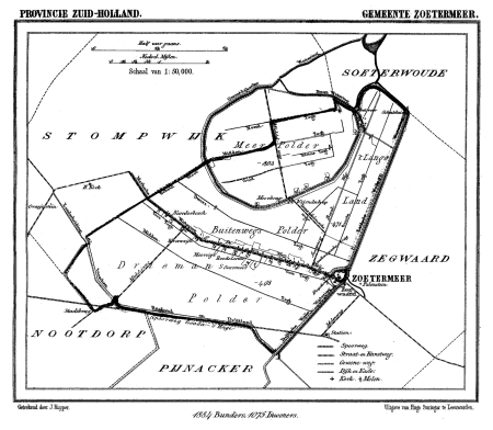
gemeente atlas van nederland - south holland
maps of zoetermeer
claes jansz. visscher (ii)
atlas van stolk
gemeente atlas van nederland - south holland
1860s maps of south holland
gemeente atlas van nederland - south holland
1860s maps of south holland
gemeente atlas van nederland - north holland
maps of uithoorn
dutch 17th-century prints in the rijksmuseum amsterdam
siege of moers 1597
gemeente atlas van nederland - north holland
maps of texel
gemeente atlas van nederland - south holland
1860s maps of south holland
media from regionaal archief alkmaar
oudkarspel
maps by willem and johannes blaeu
copper engravings
atlas minor gerardi mercatoris (1609)
maps of europe by mercator-hondius
gemeente atlas van nederland - south holland
1860s maps of south holland
gemeente atlas van nederland - south holland
maps of wassenaar
gemeente atlas van nederland - south holland
1860s maps of south holland
gemeente atlas van nederland - north holland
maps of muiden
2501 - 2600 of 7,171
Next page
/ 72


![Gerardi Mercatoris and I. Hondii Atlas or Representation of the Universal World, and of the Parts of It, Made in Tables and Descriptions Very Ample, and Exact: Divided into Two Volumes [...]. [t. 1].](https://cdn.creazilla.com/illustrations/10000622971/gerardi-mercatoris-and-i-hondii-atlas-or-representation-of-the-universal-world-and-of-the-parts-of-it-made-in-tables-and-descriptions-very-ample-and-exact-divided-into-two-volumes-t-1-md.jpg)


![Map of the polder of Nieuw-Helle-Voet / I. Luiken fecit cum aqua forti; A. Steyaart invented; I. Stemmer's sculpsit, Romeyn de Hooghe, [1701]](https://cdn.creazilla.com/illustrations/10001032148/map-of-the-polder-of-nieuw-helle-voet-i-luiken-fecit-cum-aqua-forti-a-steyaart-invented-i-stemmer-s-sculpsit-romeyn-de-hooghe-1701-md.jpg)
![Map of the craftsmanship of the Old and New Streuyt / A. Steyaart invenit; I. Stemmer's sculpsit; I. Shutters fecit cum aqua forti, Romeyn de Hooghe, [1701]](https://cdn.creazilla.com/illustrations/10000536041/map-of-the-craftsmanship-of-the-old-and-new-streuyt-a-steyaart-invenit-i-stemmers-sculpsit-i-shutters-fecit-cum-aqua-forti-romeyn-de-hooghe-1701-md.jpg)
![Map of the Ring of Putten, Gilliam van der Gouwen, [1701]](https://cdn.creazilla.com/illustrations/10001413820/map-of-the-ring-of-putten-gilliam-van-der-gouwen-1701-md.jpg)


![T Hoogh-Heemraetschap vande Uytwaterende Sluysen in Kennemerlant and West Frieslant / [Johannes Douw], Isaak Tirion, [1756]](https://cdn.creazilla.com/illustrations/10000841147/t-hoogh-heemraetschap-vande-uytwaterende-sluysen-in-kennemerlant-and-west-frieslant-johannes-douw-isaak-tirion-1756-md.jpg)


![T Hoogh-Heemraetschap vande Uytwaterende Sluysen in Kennemerlant and West Frieslant / [Johannes Douw], Isaak Tirion, [1756]](https://cdn.creazilla.com/illustrations/10000560278/t-hoogh-heemraetschap-vande-uytwaterende-sluysen-in-kennemerlant-and-west-frieslant-johannes-douw-isaak-tirion-1756-md.jpg)
![T Hoogh-Heemraetschap vande Uytwaterende Sluysen in Kennemerlant and West Frieslant / [Johannes Douw], Isaak Tirion, [1756]](https://cdn.creazilla.com/illustrations/10000976652/t-hoogh-heemraetschap-vande-uytwaterende-sluysen-in-kennemerlant-and-west-frieslant-johannes-douw-isaak-tirion-1756-md.jpg)
![T Hoogh-Heemraetschap vande Uytwaterende Sluysen in Kennemerlant and West Frieslant / [Johannes Douw], Isaak Tirion, [1756]](https://cdn.creazilla.com/illustrations/10001440533/t-hoogh-heemraetschap-vande-uytwaterende-sluysen-in-kennemerlant-and-west-frieslant-johannes-douw-isaak-tirion-1756-md.jpg)